Dubai Metro Blue Line: Route, Stations, Timeline & Economic Impact
Explore how the Blue Line Metro transforms urban mobility, addressing both benefits and challenges. Discover its role in shaping city travel—read more now!
Key Takeaways
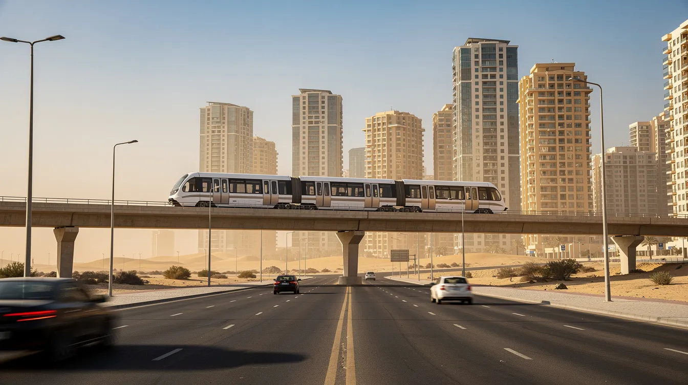
The dubai metro blue line is a 30 km Y-shaped rapid transit corridor featuring 14 new stations - 9 elevated and 5 underground - connecting the green line at Creek and the red line at Centrepoint in al rashidiya.
Key areas served include dubai festival city, dubai creek harbour (home to the world's tallest metro station at 74 m), ras al khor, international city, dubai silicon oasis, Mirdif, al warqa, and academic city.
Construction begins in June 2025, with a target opening on 9 September 2029, coinciding with the dubai metro's 20th anniversary.
The blue line is expected to reduce traffic congestion by 20%, cut airport travel times to around 20 minutes from interchange points, and lift property values by 10–25% along the blue line route.
Introduction: What Is the Dubai Metro Blue Line?
The dubai metro blue line is the third line in the dubai metro network, adding approximately 30 kilometers of track and 14 new blue line stations to a metro system that has shaped urban mobility since 2009. The project was approved on November 24, 2023, by His Highness Sheikh Mohammed bin Rashid Al Maktoum, vice president and prime minister of the UAE and Ruler of Dubai. With an AED 20.5 billion investment, it stands as one of the largest transport projects in the city's history.
The blue line incorporates a Y-shaped design for its routes, with one branch starting at creek station on the green line and the other beginning at centrepoint station on the red line, both converging at international city 1 as a central interchange station. The line connects vital residential and commercial areas to downtown Dubai, filling a gap in public transport coverage across eastern and southeastern districts that have historically depended on private cars. Construction is ramping up through 2025, with a target opening on 9 September 2029 - a date chosen to mark the 20th anniversary of the original dubai metro launch.
Blue Line Route Overview
The blue line route runs as a 30 km Y-shaped corridor with two branches that merge near dubai international city 1, forming a y junction that distributes passengers across eastern Dubai. The line provides a strategic connection across East and West Dubai, running broadly along Sheikh Mohammed Bin Zayed Road (E311) and linking residential districts, commercial hubs, and academic campuses to the existing network.
Two integration points anchor the line: creek interchange station (with the green line near dubai creek in al jaddaf) and centrepoint interchange station (with the red line in al rashidiya). Together, these connections allow the blue line to reduce overreliance on a single corridor and deliver seamless connectivity for communities like Mirdif, al warqa, international city, dubai silicon oasis, and dubai academic city.
Branch A - Creek to Academic City (Green Line Connection)
This branch covers roughly 21 km from creek interchange station in al jaddaf to academic city in the southeast. Along the way, it serves key areas in sequence: al jaddaf, festival city dubai creek, Emaar Properties Station at city dubai creek harbour, ras al khor industrial areas, dubai international city (including stations at International City 1, 2, and 3), dubai silicon oasis, and academic city.
Creek interchange station delivers the green line connection, allowing passengers travelling from Deira, bur dubai, or Al Ghubaiba to transfer onto the new metro line with minimal walking. This branch also strengthens links along the dubai creek waterfront, supporting future phases of dubai creek harbour development scheduled into the 2030s. For residents in these southeastern residential areas, it replaces lengthy bus-and-car journeys with a direct rail spine connecting them to the wider metro network.
Branch B - Centrepoint to International City (Red Line Connection)
The second route of the Blue Line begins at centrepoint station, the existing red line terminus at al rashidiya, and runs about 9 km southeast to international city 1, where it meets Branch A. This branch serves intermediate catchment areas such as Mirdif and al warqa - residential districts where commuters currently face congested arterial roads and limited bus services.
The second station connects to the Red Line at Centrepoint Station in Al Rashidiya, providing the red line connection that gives passengers direct access to dubai international airport terminals and central business districts along Sheikh Zayed Road. International City 1 functions as the junction where the two branches converge, forming the blue line's main underground interchange hub. Once operational, a resident in al warqa who previously spent 40–50 minutes driving to Dubai Festival City could complete that trip in roughly 20 minutes by metro, making this link a genuine alternative to private cars.
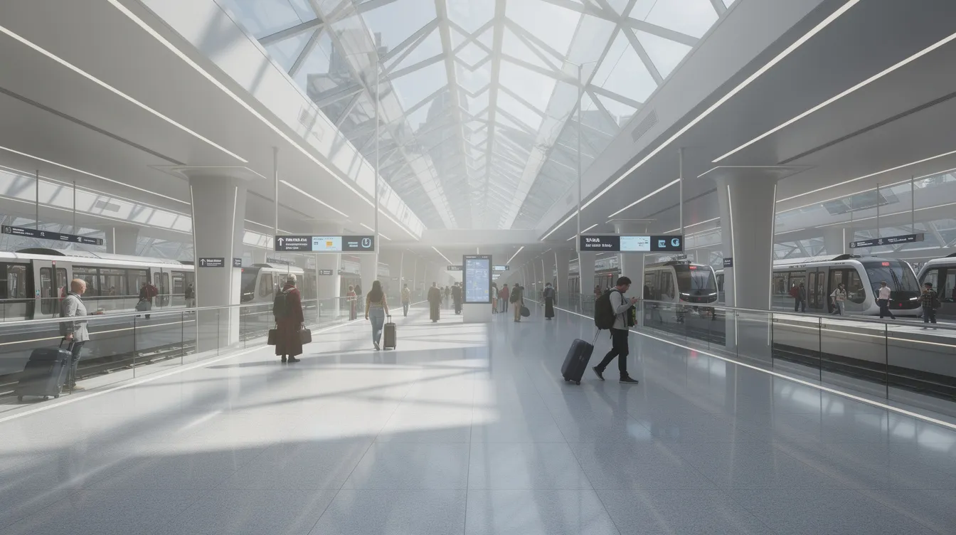
List and Description of the 14 Blue Line Stations
The dubai metro blue line will feature 14 new stations: nine stations will be elevated and five will be underground, including two major interchanges. Here is how many stations appear in route order:
Branch A (Creek → Academic City): B01 - Creek Interchange Station (underground; green line interchange at al jaddaf). B02 - Dubai Festival City (elevated; serves the dubai festival city mall and waterfront). B03 - Emaar Properties Station at dubai creek harbour (elevated; the world's tallest metro station at 74 meters, designed by Skidmore, Owings & Merrill - the firm behind the sears tower and burj khalifa). B04 - Ras Al Khor (elevated; near ras al khor industrial and wildlife sanctuary). B05 - International City 1 (underground; the largest underground interchange station spanning over 44,000 square meters, with an expected daily capacity of roughly 350,000 passengers). B06 - International City 2 (underground). B07 - International City 3 (underground). B08 - Dubai Silicon Oasis (elevated). B09 - Academic City (elevated terminus).
Branch B (Centrepoint → International City 1): Centrepoint Interchange Station (red line interchange at al rashidiya), followed by intermediate stops at Al Warqa, Mirdif, merging at International City 1.
The emaar properties station will be the world's tallest metro station at 74 meters - an iconic station and architectural landmark visible across the creek. Think of it as an olympic tower for transit: a structure rivalling the proportions of landmarks that define city skylines globally. Meanwhile, international city 1 will be the network's largest underground interchange station, processing volumes comparable to small airports.
Station Design, Themes and Passenger Facilities
The new blue line stations are organised around four natural design themes - air, water, earth, and fire - each influencing colours, lighting, and materials across different stops.
Air-themed stations use high ceilings and generous natural lighting to create openness, particularly at busy interchange points like Creek and Centrepoint. Water-themed interiors reference Dubai's maritime heritage with flowing architectural forms and calm blue-green palettes, especially near dubai creek and dubai creek harbour. Earth and fire themes bring warmer tones and dynamic lighting to residential and academic zones like dubai silicon oasis and academic city, evoking community energy and innovation.
All stations will feature barrier-free accessibility and modern amenities, including lifts, ramps, tactile guidance paths, platform screen doors, climate-controlled concourses, clear multilingual signage, and provision for retail kiosks and service outlets.
Integration with Existing Dubai Metro Network
The blue line connects to the existing red and green lines, transforming the dubai metro network from approximately 101 km and 64 stations to 131 km and 78 metro stations. The line includes specialized crossovers to facilitate transfers between lines, making the existing network far more versatile.
At creek interchange station, the blue line meets the green line, enabling direct transfers for passengers from Deira, bur dubai, and Al Ghubaiba. At centrepoint interchange station in al rashidiya, it links to the red line's airport corridor, serving Terminals 1, 2, and 3 of dubai international airport. The Blue Line aims to ease congestion by linking various neighborhoods to existing transit lines, reducing overcrowding at central transfer points along the existing red and green lines.
Complementary transport modes - RTA feeder buses, taxis, and planned micromobility services - will provide last-mile connectivity from blue line stations into surrounding neighbourhoods, supporting seamless integration across the broader public transport ecosystem.
Airport and Key Destination Connectivity
Residents of international city, dubai silicon oasis, and academic city will gain direct metro access to dubai international airport, with typical journeys to terminals targeted at around 10–25 minutes from interchange points. Before the blue line, these communities relied on cars or buses along congested arterial roads - trips that could stretch well beyond 45 minutes during peak hours.
Students and staff travelling between academic city, city-centre universities, and business districts along the red and green lines will benefit from faster, more predictable commutes. Dubai Festival City and dubai creek harbour become accessible leisure and retail destinations by metro, reducing reliance on car trips and parking demand. A sample journey from al warqa to dubai festival city - previously a car-dependent trip - becomes a straightforward metro ride via International City 1 and Branch A.
The Roads and Transport Authority (the transport authority overseeing the project) has also indicated that longer-term plans may explore linking the blue line pattern to services toward Al Maktoum International Airport, though this falls outside the confirmed first phase.
Construction Timeline, Budget and Key Contractors
Feasibility and route planning for a third metro line date back to around 2006, but the formal blue line approval came in November 2023. In December 2024, the transport authority awarded the main contract - valued at AED 20.5 billion - to a consortium of Turkish firms MAPA and Limak alongside Chinese rolling stock manufacturer CRRC.
Construction begins in June 2025, with the major construction phase lasting from 2025 to 2028 covering tunnelling, elevated viaduct erection, and station shells. Testing and integration occur between 2028 and 2029, leading to the targeted opening on 9 September 2029. As of late 2025, the project was reported at roughly 10% completion, with a target of 30% by end of 2026. This positions the upcoming blue line among Dubai's largest recent infrastructure investments.
Engineering Features and Sustainability Standards
The blue line uses a mix of elevated viaducts (approximately 14.5 km) and underground tunnels (approximately 15.5 km), with precast segmental guideways similar to those on the existing metro lines. The design balances urban integration with construction efficiency.
The Blue Line is Dubai's first project to meet platinum green building standards under the Al Sa'fat system, setting a benchmark for sustainable development in transit infrastructure. Expected energy-efficient systems include LED lighting, regenerative braking on trains, and optimised ventilation and cooling in underground sections. Noise and vibration controls near residential zones like Mirdif and al warqa preserve urban comfort while expanding transport capacity. It is expected to significantly reduce carbon emissions per passenger trip compared with equivalent car journeys.
Economic Benefits and Impact on Property Markets
The metro blue line is not simply a transport project - it is a catalyst for economic growth and urban regeneration across eastern Dubai. Every dirham invested in the Blue Line is projected to generate AED 2.60 in returns, with total economic, social, and environmental benefits exceeding AED 56.5 billion by 2040.
The Blue Line is expected to reduce traffic congestion by 20% along key road corridors, freeing capacity for freight and commercial movement. The blue line is expected to accommodate over 320,000 passengers daily by 2029, rising further as surrounding communities mature.
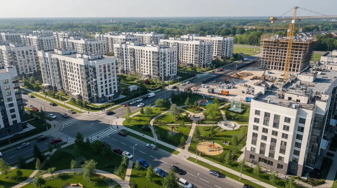
Property values near new metro stations may increase by 10–25%, with early signs already visible: studios in academic city have risen from AED 42,000 to AED 60,000 per year since the 2023 announcement - a 43% jump. Areas within 500 metres of planned stations have seen average property value growth of roughly 18.4%. However, uplift varies by micro-location, building quality, and walkability to the nearest blue line stations.
Local Business, Education and Labour Mobility
Small retailers and services around stations stand to benefit from increased footfall, particularly near major hubs like international city 1 and emaar properties station. The Blue Line will support job creation in eastern Dubai by improving access to technology-focused employers in dubai silicon oasis and educational institutions in academic city, broadening job catchment areas and boosting rental demand in surrounding residential districts.
Better transit reduces commuting times and costs for workers, supporting labour mobility and helping businesses attract talent from across the city. Improved links to leisure destinations along dubai creek, dubai festival city, and new mixed-use clusters can also boost tourism-related spending - economic benefits that compound year over year.
How the Blue Line Changes Everyday Travel in East Dubai
Before the blue line, residents of international city, al warqa, and Mirdif faced long, unpredictable car journeys on congested corridors like E311. After opening, daily travel across these neighbourhoods transforms fundamentally. It is projected to significantly reduce commuting times and local traffic congestion.
Consider three example scenarios:
International City to DIFC: Metro via International City 1, transfer at Creek Interchange to the green line, then connect to the red line - roughly 35 minutes door-to-platform versus 50+ minutes by car during rush hour.
Academic City to Deira: Direct metro to Creek Interchange, then green line northbound - approximately 30 minutes versus an unpredictable 40–60 minute drive.
Mirdif to Dubai Festival City: Metro via Branch B to International City 1, then one stop back on Branch A - around 15 minutes, replacing a 25-minute drive that balloons during peak hours.
For students, families, and frequent flyers, the reliability of a metro running at roughly two-minute frequencies beats the uncertainty of peak-hour driving. The blue line will encourage greater public transport use across demographics that previously had no practical rail option.
Sustainability, Quality of Life and Urban Planning
The blue line fits within the Dubai 2040 Urban Master Plan, which emphasises compact, transit-oriented development along major metro corridors. By 2040, the blue line corridor is expected to serve about one million residents, directing growth into eastern and southeastern quarters that have historically received less infrastructure investment.
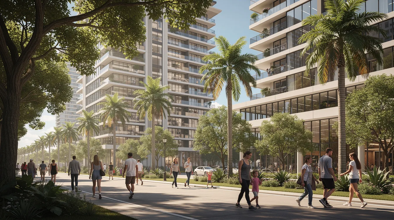
Environmental benefits include lower CO₂ emissions per passenger trip, reduced fuel consumption, and improved air quality in dense residential districts. Walkable station precincts with shaded paths and mixed-use developments can encourage residents in communities like dubai silicon oasis and academic city to shift away from car dependency. Enhancements to pedestrian and cycling infrastructure around stations contribute to healthier lifestyles and better public spaces - a tangible improvement in quality of life for key areas across the route.
FAQ - Dubai Metro Blue Line
When will the Dubai Metro Blue Line open to passengers?
The line is expected to open on 9 September 2029, a date chosen to coincide with the 20th anniversary of the original dubai metro launch. This timeline is subject to construction and testing milestones being met on schedule - the major construction phase runs through 2028, followed by systems integration and trial operations.
Will ticket prices on the Blue Line differ from other Dubai Metro lines?
Fares on the blue line are expected to follow the same zone-based Nol card system used on the red and green lines. Prices will depend on the number of zones crossed rather than the specific line, maintaining consistency across the metro network.
How accessible will Blue Line stations be for people with disabilities?
Stations are being designed with barrier-free access, including lifts, ramps, tactile guidance paths, and dedicated spaces on trains. These features align with Dubai's existing metro accessibility standards and international best practices.
Will there be parking at Blue Line stations?
Major interchange and terminal stations such as Centrepoint and selected hubs near international city and academic city are expected to offer park-and-ride facilities. Inner urban stations will focus more on pedestrian and bus feeder access to encourage public transport adoption.
Is the Blue Line expected to extend further after 2029?
The initial 30 km, 14-station network is the confirmed first phase. Any future extensions - for example, toward Al Maktoum International Airport or additional residential areas - would depend on updated planning under Dubai's long-term transport strategy and ridership demand patterns observed after launch.
Explore Metro Stations
Interchange Stations
Transfer between Red and Green lines
Total Stations: 35